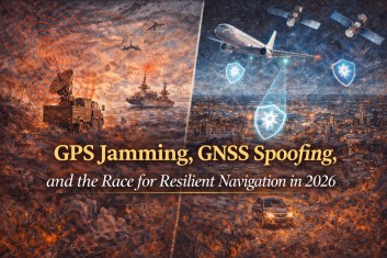
GPS Jamming, GNSS Spoofing, and the Race for Resilient Navigation in 2026
WEB'S ON FIRE
Chaifry
1/29/20266 min read
Why navigation has become critical infrastructure, how interference is reshaping aviation and maritime safety, and what the next generation of PNT resilience looks like.
Key takeaways
GNSS interference is shifting from rare disruption to routine operational risk in parts of Europe and key sea lanes, triggering explicit government and regulator warnings.
The response is a layered resilience stack: authenticated GNSS (Galileo OSNMA), alternative satellite PNT from Low Earth Orbit, terrestrial backups like eLoran, 5G Advanced positioning, and tighter detection + procedures.

AI is changing consumer navigation into a “copilot” experience, increasing reliance on location and raising the cost of failure when location confidence is wrong.
For operators, resilience is not a gadget; it is governance: monitoring, training, standard reporting, and degraded-mode procedures that keep systems safe and functional.
Navigation is entering its “trust era”
For two decades, “GPS” felt like a utility: always on, broadly reliable, and cheap enough to embed everywhere. In 2026 that assumption is visibly breaking. Interference with satellite navigation signals is now treated as a safety and security issue by aviation authorities, maritime administrations, and critical infrastructure agencies. The stakes go far beyond turn-by-turn directions. Positioning, Navigation, and Timing (PNT) services synchronize telecom networks, support air traffic surveillance, enable port operations, and keep supply chains moving. When PNT becomes unreliable, the failure can cascade: a system that “looks fine” can be quietly wrong, which is often worse than a clean outage.
What people mean by GPS jamming, GNSS spoofing, and PNT
Why 2026 feels different
Two signals (no pun intended) show the scale of the shift. First, coastal states around the Baltic Sea and the North Sea, together with Iceland, issued an open letter to the international maritime community warning that GNSS interference and AIS manipulation are increasing safety risks. The letter calls for preparedness, trained crews, and credible alternatives when satellite navigation is disrupted. Second, aviation bodies are institutionalizing responses. EASA and IATA published a coordinated plan that emphasizes standardized reporting, monitoring, and mitigation workstreams, reflecting the view that interference is an ongoing operational condition rather than an exceptional incident.
Aviation and maritime are responding because the costs are asymmetric
GNSS signals are weak when they reach the Earth’s surface, which makes them easier to block or counterfeit than many people assume. That’s why operational guidance is now so procedural: early recognition, clear crew workflows, and fallback navigation methods matter as much as the receiver hardware. EUROCONTROL’s monitoring briefings describe GNSS radio-frequency interference as becoming “normal” in some regions, with escalation to more complex spoofing patterns. In other words, even when equipment survives the first few seconds of disruption, the downstream effects can linger.
The resilience stack: what’s actually changing in navigation tech
The technical response isn’t a single silver bullet. It’s a layered stack that tries to keep position and time usable even when GNSS becomes degraded.
1) Authenticated signals: Galileo OSNMA
A major step forward is authentication. Galileo’s Open Service Navigation Message Authentication (OSNMA) is now operational, giving compatible receivers a way to verify that navigation data is genuine rather than forged. Authentication does not magically eliminate all spoofing, but it raises the difficulty of undetected deception and improves integrity monitoring.
2) Low Earth Orbit PNT: stronger signals, new options
A second trend is alternative PNT from Low Earth Orbit (LEO). Xona Space Systems raised $92M to build its Pulsar constellation, positioning it as a resilience layer for critical users who cannot afford GNSS outages or deception. The practical idea is simple: signals from closer satellites can be stronger and may provide better performance in challenging environments, especially when fused with other sources.
3) Terrestrial backups: the return of “navigation without satellites”
Resilience conversations are also bringing terrestrial radionavigation back into scope. The January 2026 maritime letter explicitly calls for developing alternative terrestrial radionavigation systems that can substitute for GNSS during disruptions. In some countries and sectors, eLoran is again being discussed as a practical backup for timing and wide-area navigation.
4) 5G Advanced positioning: the mobile network becomes a location system
On the terrestrial tech side, 3GPP Release 18 (the first 5G-Advanced release) includes work on proximity, location, and positioning, and further integration of satellite access (NTN) in the 5G system. Industry technical summaries highlight enhancements aiming at both low-power and high-accuracy positioning and new measurement methods. For smart cities, Industry 4.0, emergency response, and logistics, this matters because it reduces single-point dependence on GNSS.
5) AI copilots in Maps: better usability, higher reliance
Consumer navigation is evolving at the same time. Google Maps is rolling out Gemini-powered features such as landmark-based guidance, using Maps data and Street View to pick street-visible landmarks for directions. Apple Maps in iOS 26 is also moving toward proactive commute suggestions and delay alerts based on learned routines. This is the usability win. The risk is that as navigation becomes more conversational and “ambient,” users will rely on it more often, even when confidence should be lower.
What resilient navigation looks like in the real world
This section is written for operators, regulators, and system owners who need a practical playbook, not a theory paper.
Aviation: build degraded-mode operations as standard practice
Adopt standardized reporting and monitoring routines (radio calls, NOTAM coding, shared situational awareness), consistent with EASA/IATA recommendations.
Train for both jamming (loss) and spoofing (deception). Spoofing can look “plausible,” so crews need cross-check habits and clear triggers for escalation.
Use layered navigation sources (multi-constellation GNSS, inertial aiding, ground-based nav aids where available) and verify that alerts are usable in cockpit workload.
Feed incidents back into an operational learning loop: trends, affected regions, and equipment performance should inform routing and procedures.
Maritime: treat GNSS interference + AIS manipulation as a combined risk
Implement bridge procedures that assume GNSS can be wrong, not just unavailable. Cross-check with radar ranges, visual bearings, and chart sanity checks.
Ensure crews are trained and vessels have the capability to operate safely during outages, as emphasized by the coastal states’ open letter.
Run incident reporting through flag/port processes so interference patterns become shared intelligence rather than isolated anecdotes.
Use sector evidence to guide investment: RIN’s maritime report compiles survey data from hundreds of captains and experts on operational impacts.
Critical infrastructure: start with governance, then technology
Use structured best practices for resilient PNT in critical infrastructure, including risk assessment and layered alternatives.
Align internal resilience plans with national civil PNT strategy and coordination mechanisms.
Make detection a procurement requirement: systems should flag anomalies, not fail silently.
Where timing matters (telecom and energy especially), plan for alternate timing sources and controlled failover, not improvised workarounds.
Tech builders: design for integrity, not just accuracy
Support authentication where available (OSNMA) and design UI that communicates uncertainty, not false confidence.
Engineer multi-source fusion (GNSS + IMU + map matching + terrestrial positioning) as a default, not an optional add-on.
Test failure modes: what does your product do when it is being spoofed, not just when it loses signal?
Document and ship a clear degraded-mode experience: smaller feature set, higher confidence, fewer surprises.
What to watch next (2026)
How quickly OSNMA-capable receivers and consumer devices adopt authentication at scale.
Whether LEO PNT services move from pilots to dependable commercial SLAs for maritime, aviation, and infrastructure users.
How fast 5G Advanced positioning moves from standards into operator deployments and industrial use cases.
Whether regulators converge on consistent incident reporting and real-time warnings across regions.
How AI navigation copilots handle uncertainty and degraded positioning without misleading users.
References
The growing risks to maritime safety (Open letter from coastal states of the Baltic Sea and the North Sea with Iceland). UK Department for Transport. 26 Jan 2026.
Coastal States of the Baltic Sea and the North Sea: safety risks caused by GNSS interference (news release). Finnish Government (Valtioneuvosto). 26 Jan 2026.
EASA and IATA outline comprehensive plan to mitigate GNSS interference risks (press release). EASA. 18 Jun 2025.
EASA and IATA publish comprehensive plan to mitigate the risks of GNSS interference (press release). IATA. 18 Jun 2025.
GPS and GNSS Interference Resource Guide (PDF). Federal Aviation Administration (FAA). Accessed 29 Jan 2026.
Mitigating GNSS Radio Frequency Interference (RFI) (PDF). EUROCONTROL (Network Manager User Forum materials). Jan 2025. Accessed 29 Jan 2026.
Galileo’s OSNMA Authentication Service Now Operational. European Commission (DG DEFIS). 25 Aug 2025.
From Testing to Operations: Galileo OSNMA Service Now Available to Users. EUSPA. 5 Sep 2025.
Xona raises $92M for ‘unhackable’ PNT constellation. Payload. 27 Jun 2025.
3GPP Release 18 (5G-Advanced): Release description. 3GPP. Accessed 29 Jan 2026.
5G Advanced positioning in 3GPP Release 18 (technical overview). Ericsson. 12 Nov 2024.
Google Maps launches Gemini features, including landmark navigation. Google Blog. 2025 (published date on page). Accessed 29 Jan 2026.
Apple’s new Maps will learn your commute in iOS 26. TechCrunch. 9 Jun 2025.
Best Practices for Resilient Positioning, Navigation, and Timing (PNT) Supporting Critical Infrastructure (news release). DHS Science & Technology. 25 Feb 2025.
Xona Raises $92M to Rebuild Satellite Navigation for a New Era (press release). PR Newswire. 2025. Accessed 29 Jan 2026.
The Impacts of GNSS Interference on Maritime Safety (report summary page). Royal Institute of Navigation (RIN). Accessed 29 Jan 2026.
Positioning, Navigation and Timing (PNT) & Spectrum Management. U.S. Department of Transportation. Accessed 29 Jan 2026.
Positioning, Navigation, and Timing (PNT) best practices hub. CISA. Accessed 29 Jan 2026.